This site is supported by our readers. We may earn a commission, at no cost to you, if you purchase through links.

Each autumn, more than 40 million waterfowl pour south across North America—and they don’t wander. They follow ancient corridors carved by glaciers, guided by cold fronts and shortening days, hitting the same wetlands their ancestors used thousands of years before them.
Miss the timing by a week and you’ll find an empty marsh. Nail it, and you’ll witness one of the most breathtaking wildlife spectacles on the planet.
From Alaska’s eelgrass lagoons to Arkansas’s flooded rice fields, the best autumn waterfowl migration locations reward those who know where—and when—to look.
Table Of Contents
- Key Takeaways
- Best Autumn Waterfowl Migration Locations
- Top North American Waterfowl Flyways
- Peak Fall Migration Timing
- Weather That Moves Waterfowl
- Tracking Autumn Waterfowl Movement
- Frequently Asked Questions (FAQs)
- Where do ducks migrate in the fall?
- Which flyway has the most waterfowl?
- Which waterfowl species travel the farthest each fall?
- How do hunters select decoy spreads by location?
- What role do refuges play in population recovery?
- How does drought affect wetland stopover availability?
- Which conservation groups fund waterfowl habitat restoration?
- Conclusion
Key Takeaways
- 40 million waterfowl follow four ancient flyways every fall—Mississippi, Central, Atlantic, and Pacific—each with its own hotspots, timing, and species mix worth knowing before you head out.
- Cold fronts are the real trigger: a single 15°F temperature drop can empty a marsh overnight and stack birds a hundred miles south by morning, so watch the weather harder than the calendar.
- Teal kick things off in September, mallards and pintails peak through October–November, divers arrive after that, and swans close the show—meaning the action rolls for months if you know which species to chase when.
- Tools like BirdCast’s live radar maps and flyway forecast dashboards now let you track nocturnal flight in real time, so there’s no excuse for showing up at an empty marsh.
Best Autumn Waterfowl Migration Locations

Some wetlands just hit different in autumn—birds stacking up by the thousands, mornings thick with wingbeats and calling. Across North America, a handful of locations pull serious numbers every fall, the kind of places that make any waterfowl enthusiasts rearrange their calendar.
Habitat shifts are reshuffling who shows up and when, so brushing up on Michigan’s most common wetland birds helps you make sense of the chaos when the flocks roll in.
Here are the best spots to put on your radar.
Great Salt Lake Wetlands
Utah’s Great Salt Lake wetlands are a flyway gem you shouldn’t overlook. Brine shrimp and brine flies power a rich brine shrimp food web that fuels millions of migrants each fall.
Impounded wetland management carefully controls water level fluctuations to optimize waterfowl habitat.
The inaugural Great Salt Lake Watershed Enhancement Trust provided substantial Great Salt Lake Trust funding for wetland restoration.
Watch for Phragmites invasion threatening saline vegetation in these wetland complexes — but seasonal waterfowl movements and migration timing here still rival anywhere on the continent.
Klamath Basin Refuges
Head west to the Klamath Basin Refuges — where roughly 80% of Pacific Flyway waterfowl funnel through each fall. Water level management and agricultural leases across 22,000 farmed acres keep pintails and teal well-fed during peak seasonal waterfowl movements.
Habitat restoration and tribal partnerships strengthen this flyway corridor year after year.
It’s also prime bald eagle habitat — bonus wildlife watching you won’t forget.
Mississippi Alluvial Valley
Now shift your gaze east — the Mississippi Alluvial Valley is the Mississippi Flyway’s beating heart.
Bottomland forests, moist soil wetlands, and flooded rice fields create a buffet that mallards can’t resist. Floodplain hydrology drives it all.
Top reasons it dominates migration timing:
- Seasonal migration windows stretch from October through January.
- Agricultural water management floods fields on cue.
- Conservation incentives fund massive habitat restoration.
- Waterfowl flyway maps show peak concentrations here every fall.
Montezuma Wetlands Complex
Swap the Gulf Coast fields for central New York — the Montezuma Wetlands Complex plays a completely different game. Over 500,000 Canada geese pass through here every fall.
Managed Drawdowns trigger Invertebrate Pulses that fuel migration timing perfectly. Sediment Dredging builds a rich Habitat Mosaic across 7,500 acres.
Check any Waterfowl Migration Map — this Atlantic Flyway gem lights up every autumn.
Izembek Lagoon
Few places on the Pacific Flyway hit like Izembek Lagoon. This Ramsar International Site in Alaska holds 90% of the world’s Pacific brant — all drawn to 116 square kilometers of eelgrass.
Eelgrass Carbon Storage and Tidal Flat Dynamics create a feeding engine unlike anything else. Predator Prey Interactions shape daily rhythms here, underscoring the lagoon’s ecological complexity.
Watch your waterfowl flyway maps — Peak Fall Migration Windows ignite fast under Wilderness Refuge Management, ensuring the sanctuary’s critical role in avian conservation.
Top North American Waterfowl Flyways
North America’s waterfowl don’t wander randomly—they follow four major flyways that have shaped hunting traditions, conservation efforts, and wildlife spectacles for generations.
Each flyway has its own personality, its own timing, and its own must-see hotspots worth knowing. Here’s a closer look at what makes each one worth your attention.
Mississippi Flyway Hotspots

The Mississippi Flyway moves roughly 40% of North America’s autumn waterfowl — and you’ll feel that weight the moment a cold front sweeps through.
Missouri Stopovers and Kankakee Riverlands light up first. Then Arkansas Public Marshes, Riverine Marshes, and Delta Refuges fill fast.
Use waterfowl flyway maps and flyway monitoring tools to nail your Peak Fall Migration Windows before the crowds do.
Central Flyway Wetlands

The Central Flyway stretches across the Great Plains, funneling over 50% of North America’s migratory waterfowl. This vital route relies on the Prairie Pothole Networks, where the journey begins.
Seasonal Flooding transforms millions of shallow basins into critical habitats, providing ducks with essential resources before their southward migration.
Wetland Restoration and strategic Hydrologic Management sustain these vital stopovers, ensuring the ecosystems remain functional and resilient.
Refuge Partnerships safeguard the precise timing of these natural processes—a necessity for the success of the fall migration window.
Atlantic Flyway Marshes

The Atlantic Flyway runs from Canada to the Caribbean — and it’s a masterpiece of migration routes.
Coastal salt marshes packed with Spartina Habitat, Tidal Creeks, and Invertebrate Prey fuel rapid fattening for mallards, black ducks, and blue-winged teal during peak migration timing.
Marsh Restoration and Ramsar Protection keep these wetlands functional.
Think of it as waterfowl migration’s eastern expressway — rebuilt and ready.
Pacific Flyway Stopovers

The Pacific Flyway is the west coast’s great waterfowl highway — and it delivers. Birds pour down from Alaska through California, hitting premier stopover sites along the way. Here is where the action happens:
- Copper River Delta kicks off the journey — massive flocks refuel before crossing open water
- San Francisco Bay and Suisun Marsh shelter millions mid-route
- Coastal Estuarine Pools provide rapid fattening during critical migration timing
- Klamath Basin regulates water levels to match peak migration routes
- Southern California Bays close out the flyway in style
Peak Fall Migration Timing

Waterfowl don’t all move at the same time — and that’s actually what makes autumn so exciting. Different species hit their stride weeks apart, which means the action keeps rolling from September clear into December.
Here’s how the timing breaks down, species by species.
Early Teal Movements
Teal don’t wait for permission to migrate. Blue-winged teal kick off fall migration earlier than almost any other waterfowl — peak numbers hit most flyways by September. Early migration timing means teal flock dynamics shift quickly, so if you’re chasing waterfowl migration this fall, start early.
Watch shallow wetland refugia and staging pond networks; that’s where fat accumulation happens fast.
Dabbling Duck Peaks
After teal lead the charge, mallards, gadwalls, and northern pintails follow — peaking from late September through November. Flooded croplands pull huge numbers fast. Watch for regional peak shifts across the Atlantic flyway, where migration timing can vary by a week or two.
Key dabbling duck magnets:
- Shallow water depths under 20 cm enhance feeding
- Emergent vegetation offers shelter and seeds
- Invertebrate forage fuels juveniles mid-migration
- Cold fronts sharpen migration peak dates overnight
Diving Duck Arrivals
After dabblers thin out, the divers show up — and they run on a different clock. Buffleheads hit estuary peaks through October and November in what birders call Bufflehead Estuary Peaks. A Coastal Scaup Surge follows in southeastern bays by December.
Inland, the Inland Canvasback Build and Ring‑necked Lake Arrival occur through November. Meanwhile, Lesser Scaup Flooding dominates midwestern lakes, showcasing classic fall migration patterns.
Goose Migration Windows
Geese run on instinct—Daylength Cues and Hormonal Triggers fire up their engines before the cold even arrives. Latitude Shifts begin in late September, with peak geese migration rolling through October across all major flyways.
Staging Duration varies, but Flock Size Variability keeps things interesting:
- Cold snaps accelerate migration windows overnight
- Seasonal Shifts can delay departures by a week or two
- Bird migration timing peaks in mid-October across most flyways
- Agricultural fields extend staging stays considerably
Swan Migration Peaks
Swans signal the end of the fall parade, with their arrival windows opening in October. Tundra swans reach peak numbers in November along the Atlantic and Mississippi migration flyways. Their movement is guided by simple weather cues: when frost hits, they migrate.
| Feature | Detail | Timing |
|---|---|---|
| Swans’ Habitat Preferences | Shallow marshes, quiet ponds | Oct–Nov |
| Swans’ Migration Distances | 30–80 km daily | Peak fall migration |
| Swans’ Flight Speeds | Boosted post-cold front | November peaks |
Weather That Moves Waterfowl

Waterfowl don’t move on a calendar—they move on weather. A single cold front can empty a marsh overnight and fill the next one a hundred miles south by morning.
A single cold front can empty a marsh overnight and fill the next one a hundred miles south by morning
Here’s what actually pulls the trigger.
Cold Front Pushes
A cold front hits like a switch being flipped. Dense air undercuts warm air—sharp temp gradients drop 15°F in hours, winds gust to 40 mph, and barometric pressure spikes. That’s your frontal pressure spike.
Birds feel it instantly. Cold-front-driven movement surges across migration flyways as flocks make rapid bird flight adjustments, riding the northwest push south toward open wetlands.
Killing Frost Events
When temperatures drop to 28°F or below, Frost Formation Physics kicks in fast — cell membranes rupture, aquatic vegetation dies, and waterfowl have no reason to stay. That’s Ecological Frost Impact in action. Within 48 hours, cold-front-driven movement surges across flyways.
Watch for these signals during fall bird migration patterns:
- Hard freezes closing Prairie Pothole wetlands by October
- Killing frosts collapsing food sources overnight
- Migration windows opening suddenly after frost events
North Wind Patterns
North winds are nature’s starter pistol. When a high-pressure system pushes southeast, it sends rapid temperature drops of 6–12°C barreling through flyways within 24 hours. Birds follow these currents as they migrate.
Mountain gap flows funnel the cold air into concentrated corridors, creating ideal conditions for migration. Watch wind gust forecasting closely; gusts exceeding 20 m/s signal that peak migration windows are opening.
Coastal salinity shifts also nudge diving ducks toward sheltered marshes fast.
Freeze-Up Migration Triggers
When shallow wetlands freeze overnight, birds don’t wait around. Ice Edge Dynamics and Surface Freeze Timing work together like a starting gun — once Lake Ice Extent hits 60%, expect mass departures within days.
Watch for these freeze-up triggers:
- Frost Depth Impacts disrupt feeding when ground frost reaches 2–5 inches
- Snow Cover Effects block grain fields, redirecting flocks fast
- Three consecutive freezing nights spike energy costs dramatically
- Weather front impact accelerates cold front-driven movement within 48 hours
- Snow cover influence and seasonal water level changes combine to push birds south
Post-Front Wetland Activity
Once a weather front clears, the wetland awakens rapidly. Nutrient pulses flood shallow basins, triggering blooms of aquatic invertebrates and sharp increases in duck populations within days.
| Post-Front Signal | What Happens | Why It Matters |
|---|---|---|
| Ice Edge Cracking | Exposes foraging zones | Dabblers move in quickly |
| Emergent Plant Flush | Vegetation growth surges | Cover and food increase |
| Shallow Pond Expansion | Microhabitat refugia widen | More birds, less competition |
Wetland management and strategic water level adjustments play a critical role in sustaining these ecological shifts.
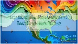
Tracking Autumn Waterfowl Movement
![]()
Knowing when birds are moving is half the battle—and these days, you don’t have to guess.
The tools available to modern birders and hunters make tracking autumn waterfowl movement easier than ever. Here’s what you should have in your back pocket this fall.
Live Migration Maps
Want to know exactly where the birds are right now? BirdCast’s migration map live tool makes that possible. Powered by multi-source data and real-time updates, it shows migration intensity maps updating constantly during peak flight nights. Hotspot annotations point you straight to the action.
Three reasons to use interactive map tools tonight:
- Real-time bird counts reveal movement before dawn
- Uncertainty visualization flags radar gaps honestly
- Interactive timeline lets you replay last week’s flight
Radar Migration Traffic
BirdCast goes deeper than pretty maps. NEXRAD radar measurements capture nocturnal bird migration traffic across hundreds of species—BMTR Conversion turns raw radar signals into real population numbers. Demographic Adjustments sharpen those estimates further.
Vertical Radar Profiles reveal flight altitude, while BirdFlow Comparison validates the data against known flyway corridors.
Migration intensity maps update constantly, giving you bird migration radar data that actually means something.
Flyway Forecast Tools
Radar data tells you what moved. Flyway Forecast Tools tell you *what’s coming.
*
Wind Suitability Scores, Habitat‑Specific Alerts, and Front Arrival Countdown timers combine into a single dashboard — powered by migration forecasting models that blend satellite winds with ground stations.
Here’s what sets it apart:
- Custom Hotspot Mapping pins your favorite marsh or mudflat
- Confidence Metrics flag forecast reliability before you load the truck
- Migration alerts fire when conditions change in your habitat
BirdCast’s migration map is updated live hourly.
Birding Trip Planning
Once your forecast is locked in, it’s time to actually get out there. Good birding trip planning transforms migration routes from abstract dots on maps into tangible experiences.
| Category | Action |
|---|---|
| Site Access & Permit Management | Confirm access, fees, closures |
| Gear Checklist | Scope, layers, power bank, field guide |
| Observation Schedule | Dawn dabbling ducks, dusk diving ducks |
Align your itinerary with seasonal migration patterns—and embark on your journey.
Frequently Asked Questions (FAQs)
Where do ducks migrate in the fall?
Like clockwork, ducks follow ancient flyways south each fall — driven by energy demands, shifting weather, and instinct.
They trace migration routes across wetlands, marshes, and rivers, stopping wherever food and safety align.
Which flyway has the most waterfowl?
The Mississippi Flyway wins—it carries roughly 40% of all North American waterfowl each autumn. No other corridor comes close for overall bird counts, seasonal density trends, or harvest yield comparison.
Which waterfowl species travel the farthest each fall?
Some birds barely leave the neighborhood. Others? They rewrite the map entirely.
The Arctic Tern holds the record—up to 60,000 kilometers round trip. For pure migration endurance, nothing else comes close.
How do hunters select decoy spreads by location?
Every location demands its own spread. Match your decoy density planning and wind‑aligned layouts to the habitat.
Species‑focused configurations and terrain‑adjusted spreads seal the deal — realistic decoys fool wary birds fast.
What role do refuges play in population recovery?
Refuges are the backbone of waterfowl recovery — offering habitat buffering, genetic diversity, and recolonization source potential.
Through refuge connectivity and threat mitigation, these critical habitats anchor population trends and drive lasting habitat restoration.
How does drought affect wetland stopover availability?
Drought hits stopover sites hard, shrinking water levels and collapsing food webs, while forcing refuge concentration into fewer wetlands.
Hydroperiod reduction kills moist soil vegetation fast, gutting habitat suitability and pushing birds onward before they’ve refueled.
Which conservation groups fund waterfowl habitat restoration?
Ducks Unlimited Funding and Nature Conservancy Grants lead the charge, backed by NAWCA Matching Grants — where partner dollars stretch every federal dollar further.
Private Landowner Programs and International Cross‑Border Funding round out these trusted partners in waterfowl conservation efforts.
Conclusion
The ducks don’t RSVP—they just show up. And when they do, you’d better already be boots-deep in the right marsh. Miss the window and you’re watching an empty sky. Get it right, and nature hands you something worth every cold, muddy, pre-dawn morning.
Mastering autumn waterfowl migration locations means reading cold fronts like a forecast, knowing your flyway, and respecting the timing these birds have followed since long before GPS existed.
- https://migrationstationusa.com/migration-reports-2024-2025-2/
- https://www.curlewcall.org/bird-migration-map-2025-track-live-routes-flyways-usa/
- https://cpree.princeton.edu/news/2023/new-map-stopover-hotspots-provides-insights-conservation-eastern-us-migratory-landbirds
- https://www.divebombindustries.com/blogs/news/a-complete-guide-to-tracking-waterfowl-migration-for-hunting?srsltid=AfmBOoqkAxwRk-CgnJlcPMVtRnPWOlnhFhGOugAPX8KLFMNnalZ2_dEL
- https://www.smithsonianmag.com/travel/best-places-america-see-fall-bird-migrations-180953083/